
This is the penultimate installment (yay!) of posts from the trip to Alaska my son and I took in spring 2021. This post covers the first part of the story of awesome flights into the wilderness to see Denali, the world’s tallest mountain (more on that later) and other Alaska Range peaks and glaciers in Denali National Park.
For nearly everyone on the planet who missed out on the previous posts, links to them are below. In addition to Part I and Part II of this post, I recommend the ones covering the Utqiaġvik tour with a former Thai Buddhist monk, subsistence whaling in the Arctic Ocean by Inupiat whaling crews, and the review of Talkeetna activities. Those with an interest in air travel under current conditions may enjoy the posts on flights, lounges, airplanes and hotels.
Other posts from the Alaska trip in May 2021.
Three Days And Zero Nights In Utqiaġvik, Alaska May 2021
Covid-19 Flight Review – American Airlines A321 First Class Charlotte, NC to Phoenix, AZ
Lounge Review Twofer – American Express Centurion Lounge And Escape Lounge Phoenix, AZ
American Airlines A321neo First Class – Phoenix, AZ To Anchorage, AK
Anchorage Airport Hotel Photo Review – Alex Hotel & Suites Anchorage, AK
Lounge Review – Alaska Airlines Lounge Anchorage, AK
Alaska Airlines 737-700 Domestic First Class Anchorage, AK to Utqiaġvik, AK
The King Eider Inn Utqiaġvik, Alaska
Hunting The Bowhead Whale In Utqiaġvik, Alaska
Denali Brewing Co., Talkeetna, Alaska
Best Things To Do In Talkeetna, Alaska
American Airlines DFW Terminal A Admirals Club – Photo Review
Just as with our visit to Utqiaġvik, flightseeing in the Alaska Range was a repeat of one of the activities from a trip I took with my son in the early 2000s. From that experience, we had a good idea of what we were getting into. We used the same air service for this flight.

Denali, the tallest mountain in North America at just over 20,300 ft (6,187 m), has been a personal interest since reading Minus 148º more than 30 years ago. It recounts the absorbing story of the first successful winter ascent of Denali (then known as Mt. McKinley) in 1967. Recollections of the book and tales of other explorations and mountaineering expeditions in the area added even more drama to the inhospitably stark scenery we flew into.
Talkeetna Air Taxi
Talkeetna Air Taxi (TAT) was founded as Talkeetna Air Service in 1947 by one of the legends of Alaska Range aviation, Don Sheldon. The company has an impressive history that includes mapping expeditions, ferrying climbers and gear, supplying remote cabins, mountain rescues, and flightseeing.
In the early days, Talkeetna Air Taxi was a kind of an amalgamation of Uber and The Shawshank Redemption’s “Red” Redding for the upper Matanuska-Susitna Valley and Alaska Range. The company did a great job on our flightseeing tour in the early 2000s, and we stuck with it this time, too.

In terms of planes and equipment, if not mission, TAT has come a long way since the early days when Don Sheldon was flying a lone Piper Super Cub. The company now has a fleet of nine single-engine aircraft — six de Haviland Canada DHC-3 Otters, one Cessna 185, and two Robinson R44 helicopters. They are all high-wing aircraft that provide excellent downward visibility and short-field takeoff and landing capability.


Most of TAT’s business now consists of sightseeing flights, but it still flies many climbers to mountain base camps and provides customized support for climbing expeditions from all over the world.
Sheldon Air Service and K2 Aviation are among other companies in Talkeetna that offer flightseeing in the Alaska Range. Alaska Range flightseeing is also available from Anchorage, Alaska 110 miles (177 km) to the south of Talkeetna.
Flights
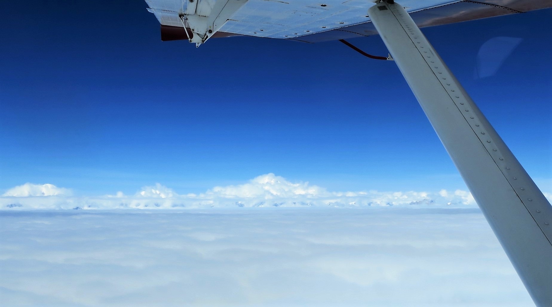
The way things worked out, I ended up taking two sightseeing flights. The weather on the first day, May 16, 2021, was pretty cloudy in the mountains. While there were great views aplenty in between the clouds, visibility at the glaciers landing fields wasn’t good enough for the pilot to risk putting the de Haviland Otter on the snow. It was disappointing to lose the chance to walk on a glacier and, if we’d landed, the pilot had promised to move me to the co-pilot’s seat.
The next day, the weather seemed to have improved. I called Talkeetna Air Taxi and negotiated a reasonable discount for taking a second flight.
Flightseeing is expensive. A single two-hour flight cost more than the flight for the nearly 10,000 mile roundtrip from Charlotte, North Carolina to Anchorage, Alaska. Still, I find flightseeing to be an expense I’m happy to incur every few years or so.
TAT offers four tours. The shortest flight is the Southside Explorer, an introduction to the Alaska Range and the terrain around Talkeetna. This flight lasts one hour and costs $220. The most expensive flight, the Summit Tour, is a two-hour flight above the 20,310ft. (6,190m) summit of Denali. De Haviland Otters aren’t pressurized so this flight requires using supplemental oxygen for the pilot and passengers above 12,500ft. (3,800m). It costs $485 and includes a glacier landing.
We selected the Grand Denali tour, a 1.5-hour flight that covers the most area in the Alaska Range. It costs $345. Adding a glacier landing adds $100 and a half hour to any tour. Prices include the $15 Denali National Park admission fee. Although each of the tours has a prescribed flight plan/itinerary, weather conditions dictate the actual flight path and what is and isn’t seen on any given flight.
Passengers meet at the TAT office at Talkeetna Airport 30 minutes before scheduled departure. That allows time for collecting fees, being fitted with glacier boots, a short preflight orientation, and time to peruse the wide array of TAT souvenirs in the gift shop.
I’m normally shopping adverse, but in this case a little retail therapy was just what the doctor ordered. It was an opportunity to replace the TAT T-shirt I bought about 20 years ago. Alex and I each picked up a couple of T-shirts and a hat.
Staff assist passengers with selecting glacier boots to facilitate walking after the glacier landing.

Andy Young was the pilot on our first flight. He is very experienced in mountain and cold weather flying having spent 20 years working in the Antarctic and 15 years supporting scientific research on the Juneau Icefield in southern Alaska.

Leighan Falley was the pilot for the second flight. A native Alaskan, Leighan worked as a mountaineering guide out of Talkeetna before obtaining a commercial pilot’s license and joining Talkeetna Air Taxi in 2015. She is one of the few climbers to have summitted Denali twice in a span of six days.
Pilot and passengers on Pika Glacier, Denali National Park.
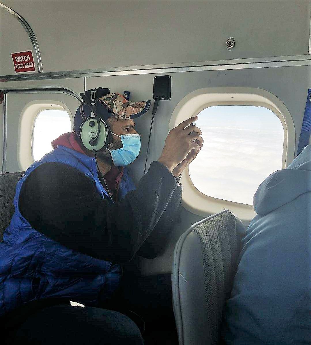
TAT de Haviland Otters are configured with 10 seats, including two in the cockpit. Every seat is next to a window and is equipped with David Clark noise-cancelling headsets. Everyone can hear and talk to each other clearly on the headsets without having to yell over the engine noise.
Seating is 1-1 which provides plenty of shoulder room. Rows are pretty tight though. Taller people should consider taking a seat in the last row. Those seats have enough room to stretch out your legs.

Undoubtedly, the best seat is the one in the cockpit next to the pilot. It has the best view and no legroom issues. I sat up front on the second day when we landed on Pika Glacier.

Talkeetna Air Taxi stows enough food and clothing in the cargo hold for 11 days of survival if the plane went down.

All TAT aircraft are equipped for flight in instrument meteorological conditions, i.e., cloud. In addition, TAT added ADS-B In/Out to all of its aircraft in 2018.

In essence, ADS-B paints a visual picture of the surrounding terrain and displays information about nearby aircraft if those aircraft are ADS-B equipped. ADS-B tells the pilot the location, altitude, heading, speed of, and distance to each aircraft. ADS-B also receives weather reports, and weather radar through flight information service broadcasts.
In 2019, the Federal Aviation Administration issued a commendation to Talkeetna Air Taxi for voluntarily installing ADS-B In/Out on its aircraft. TAT’s move to install ADS-B may have been sparked in part by the 2018 crash of a K-2 Aviation plane on Thunder Mountain near Mt. Hunter. The pilot and four Polish tourists died. Those were the first fatalities on a Denali sightseeing flight since 2003.
Coincidentally, Leighan’s husband was the National Park Service incident commander of the search-and-rescue effort for that crash. Her engrossing account of it is here. It is more than worth the effort of a three-minute read.
TAT has an excellent safety record. The only TAT accident I discovered occurred in February 2020 when one of its helicopters wound up on its side while trying to land on a glacier. There was one minor injury in that mishap.
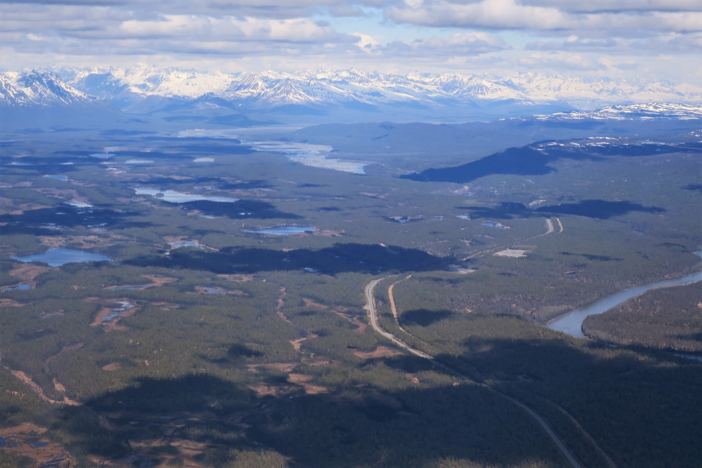
Flightseeing begins at takeoff. Departing Talkeetna, count on great views of the area around Talkeetna and the upper Matanuska-Susitna Valley.


The Alaska Range And Denali National Park
Views of the valley serve as prelude to the main event, flying around the mountains of the Alaska Range in Denali National Park. The Alaska Range is a narrow, curving 400-mile (650km) long mountain range in Southcentral Alaska.
The range acts as a barrier to the northward flow of moist air from the Gulf of Alaska. Thus, these mountains are known for heavy snowfall and some of the harshest weather in the world. Accumulated snow feeds numerous glaciers extending from the flanks of the range.

Denali National Park and contiguous preserve encompass more than 6,000,000 acres (9,446 sq mi, 24,464 km2). That is larger than five U.S. states.
The three highest peaks in the range are situated next to each other. There’s Denali, of course, Mount Foraker (17,400 ft, 5,304 m) 14 miles southwest of Denali, and Mount Hunter (14,573 ft, 4,442 m) eight miles south of Denali.
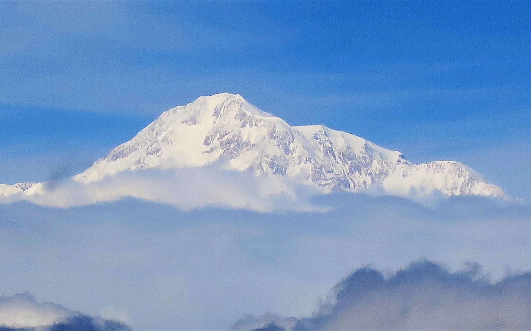
The World’s Tallest Mountain – Denali
Denali boasts the highest summit of any North American mountain (20,310 ft/ 6,190.5 m) when measured against mean sea level. Mount Everest’s summit is the world’s highest in terms of altitude 29,029 ft (8,848 m) above sea level. But there is more than one way to measure the size of a mountain.
When measured from base to the summit, Denali is the world’s tallest mountain. It rises about 18,400 ft (5,600 m) from the elevation at its base to the height at the summit. In comparison, Everest measures about 12,000 ft (3,657m) to the summit from its base at about 17,000 ft (5,181m). That’s not to sell Everest short. It presents an imposing figure as I can personally attest to based on a visit to Everest Base Camp – Tibet in 2018.

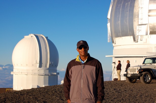
If the tallest mountain is determined by measuring from its base including mountains with a base underwater, then snow-capped Mauna Kea in Hawaii USA would be the tallest. That volcanic colossus rises 33,464 ft (10,200 m or 6.3 vertical miles) from the floor of the Pacific to the summit 13,803 ft (4,207m) above sea level. Most of Mauna Kea is submerged. In 2011 I visited the summit which is accessible to the public via four-wheel drive vehicles most of the year.
The other mountain that can be defined as the tallest is Mount Chimborazo in Ecuador. Because the Earth is an oblate spheroid that bulges in the middle and Chimborazo is located on the equator, Mount Chimborazo’s peak at an elevation of 20,548 ft (6,263 m) is the furthest point on Earth from Earth’s center. The summit is about 6,800 feet (2,072 m) farther from Earth’s center than Mount Everest’s summit.
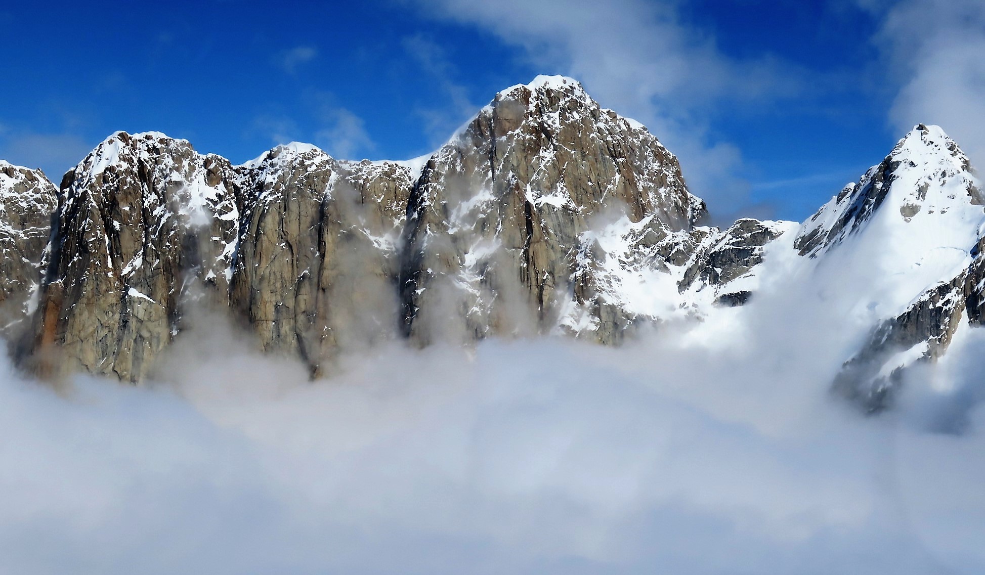
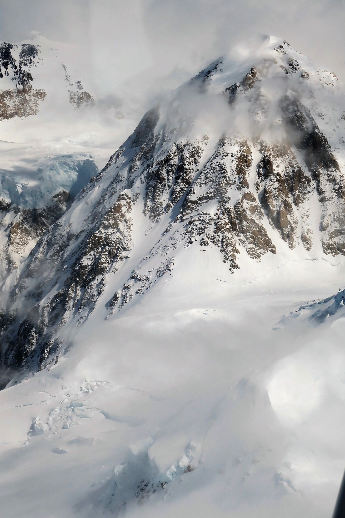
The next six photos are of Denali, the world’s tallest mountain – by one definition anyway.


The pilots described the scenery as we flew past. I can’t identify the specific location of many of the photos below. In addition to Denali, we also flew in the area of Mts. Hunter and Foraker, the Ruth Glacier, the Mooses Tooth (sic), the Great Gorge, Don Sheldon Amphitheater and the Kahiltna Glacier. If any photos are unidentified or misidentified, feel free to add information in the comments.


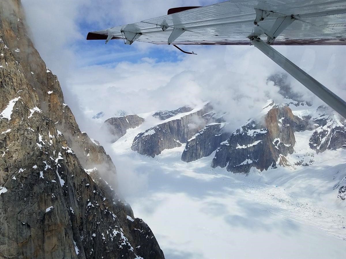
The first flight on May 16, 2021, was slated to land at Denali Base Camp on Kahiltna Glacier to drop off climbers. Weather reports from base camp nixed that idea before takeoff. In fact, clouds and low visibility closed all of the glacier landing sites that day. The next day, the weather improved enough to permit a glacier landing.
Thanks for sticking with this unusually long but hopefully interesting post. Stay tuned tomorrow for Part II Glaciers Galore that covers the glacier landing and other glaciers of Denali National Park. It also takes a look at the privately owned chalet that is available for rent only eight miles from the summit of Denali.

Beautiful pictures. Thanks
LikeLiked by 1 person
Thank you! I’m glad to share them and just wish they could convey the grandeur of the place.
LikeLike
I have always thought that Everest is the tallest. Nice pictures! 🙏🙏🙏
LikeLiked by 1 person
The answer to which mountain is tallest depends on how you ask the question. Thanks for your thoughts.
LikeLiked by 1 person
Meaning?
LikeLiked by 1 person
Meaning are you measuring “tallest” by height above sea level, distance from base on land to summit, distance from base even where underwater to summit, or distance from the center of the Earth to summit. Each measurement produces a different answer.
LikeLiked by 1 person
Most people would go by height of the summit above sea level, in which case Everest is tallest.
LikeLiked by 1 person
Ah…. TQ for explaining🙏
LikeLiked by 1 person
You are most welcome. Sorry for creating any confusion with the post and previous responses.
LikeLiked by 1 person
WOW! What an amazing experience and those photos are just epic. Such a special trip to take with your son, and what an adventure for you both to treasure. Thank you for sharing it with us 🙂
LikeLiked by 1 person
My pleasure to share. Alaska has epic scenery everywhere. We really enjoyed the trip.
LikeLiked by 1 person
More amazing pictures! The comparison to Everest made me think of a picture we posted when Richard was climbing Everest. The picture is a mountain that is roughly the same height of Denali and is being dwarfed by the Himalayan giants. Maggie
LikeLiked by 1 person
Richard must have some great photos of his Denali climb. I love the view of Everest from EBC-Tibet. It is only about a half mile shorter than Denali. Denali is pretty awesome and easier to get too.
LikeLike
We couldn’t see Everest from Tibet’s EBC, a huge cloud had rolled in and wouldn’t move. He has amazing pics from Denali, we did pot them a few months ago.
LikeLiked by 1 person
Yes. Those photos and the others from the 7 summits trips were amazing.
LikeLiked by 1 person
what an incredible experience and what a brilliant way to explore this region of the earth John, fantastic!
LikeLiked by 1 person
The best thing was we got to travel a long way and didn’t have to worry about international travel issues.
LikeLike
WOW!! Your pictures are stunning, what an incredible experience.
LikeLiked by 1 person
I’m glad you liked the photos, lyssy! You are an expert on stunning photos.
LikeLiked by 1 person
Thank you! 😊
LikeLiked by 1 person
Amazing photo’s! I am actually speechless at the beauty of this area – you’ve captured it so well! Thanks for sharing this wonderful flight!
LikeLiked by 1 person
Thanks for your kindness in reading and commenting. John
LikeLiked by 1 person
Awesome posts! Alaska is on my travel list. Gorgeous photos!
LikeLiked by 1 person
The flights were a blast even without great weather. I’m ready to go back. 😄
LikeLike
that was fascinating; thanks for giving us the chance to take that flight vicariously with you and your son.
LikeLiked by 1 person
I’m pleased to share the experience. Thanks for checking out the post.
LikeLiked by 1 person
I always enjoy reading about your adventures…
LikeLiked by 1 person
Wow, the Denali photos are breathtaking, a stunning view of the dramatic mountain. My son did a heliflight to hike on a glacier in Iceland. Although he had trekked on glaciers in Colorado, this was an exciting way to experience the country.
LikeLiked by 1 person
Hiking on a glacier in Iceland must have been quite an adventure. Your son would probably love Alaska.
LikeLiked by 1 person
Yes, we split up that day, I took a different hike, but his was much more dramatic. He worked on a ship of the Alaska coast for many years (with NOAA).
LikeLiked by 1 person
Wow! Stories to tell there, I’m sure.
LikeLiked by 1 person
What in incredible experience and a great way to see Denali and the surrounding area. Your pictures are beautiful. Looking forward to reading about part II of your adventures.
LikeLiked by 1 person
I wish I could have had time to do some hiking in the area like in your outstanding posts. Thanks for dropping by.
LikeLiked by 1 person
Awesome photos and descriptions. Thanks for sharing.
LikeLiked by 1 person
Much appreciated Swabby!
LikeLiked by 1 person
Awesome pics! Feel lucky to have found your blog. A treasure find here!
LikeLiked by 1 person
Thanks for the kind thoughts. The feeling is mutual.
LikeLike
I love flying over Denali and The Wrangells. These captures are wonderful.
LikeLiked by 1 person
I bet you have outstanding pictures. I’d love to see the Wrangell’s from the air, or just about anywhere in Alaska. Thanks for commenting Cindy!
LikeLike
Incredible! We felt lucky just to see Denali from the train, but that was no comparison to this.
LikeLiked by 1 person
You are one of the few who knows how truly spectacular that area is. I appreciate your following the blog! John
LikeLiked by 1 person
Fabulous photos, looks amazing. Would love a flight in that plane 😁
LikeLiked by 1 person
Hi! It’s great you enjoyed the photos. Thanks for reading! John
LikeLiked by 1 person
Wow! Absolutely stunning photos of Denali, what an experience!
LikeLiked by 1 person
The weather wasn’t the best but it was still a great experience.
LikeLiked by 1 person
Stunning scenery John. Flight seeing in a small plane is so wonderful . We flew from Queenstown to Milford in NZ. It was a wonderful up close look at wild country scenery. Hope all is well with you. Allan
LikeLiked by 1 person
Thanks for your comment Allan. Flightseeing in New Zealand is something I’d like to do one day. You can cover a lot of inaccessible territory that way.
LikeLiked by 1 person